The Rio Grande has an average depth of about 3-20 feet. Its deepest point reaches up to 60 feet.
The Rio Grande is a major river that shapes the border between Texas and Mexico, extending for 1,896 miles.
As one of the principal rivers in the southwest United States and northern Mexico, it is a significant geographical feature, central to water supply and biodiversity in the region.
The depth of the Rio Grande varies significantly along its course, affected by seasonal changes and regional geography.
This variance in depth makes it a challenging river to navigate, impacting not just local wildlife but also human activities such as irrigation, border security, and recreation.
The Rio Grande’s depth and the surrounding ecosystem play a crucial role in the cultural and environmental landscape where it flows.
Exploring The Depths Of The Rio Grande
Welcome to a fascinating journey beneath the surface of one of North America’s most storied rivers, the Rio Grande.
Known for its twisting path and historical role as a border and a lifeline, its depth holds secrets as compelling as the tales told on its banks. Join us as we dive into Exploring the Depths of the Rio Grande.
Historical Significance Of The Rio Grande’s Depth
The Rio Grande has been an essential waterway for centuries. Its depth has influenced settlements, agriculture, and transportation. Early Native American tribes revered the river for its life-sustaining powers. Spanish explorers used it for navigation and trade.
- Trade routes flourished along its banks.
- Military battles were shaped by its breadth and depth.
- Cultural exchange blossomed around this liquid boundary.
The depth of the Rio Grande has seen both drought and flooding, each leaving its mark on history. Pioneers and settlers relied on the river’s ebb and flow to sustain their communities, a testament to its perennial impact.
Current Measurements And Scientific Methods
Modern technology provides accurate insights into the Rio Grande’s depth. Scientists and hydrologists use sophisticated tools to measure and monitor the river. Data collection is vital for research and managing water resources.
| Method | Description | Use |
| Sonar Technology | Uses sound waves to measure depth | Creates detailed depth maps |
| GPS Mapping | Combines location with depth data | Tracks changes over time |
| Remote Sensing | Utilizes satellite imagery | Assesses large-scale environmental impacts |
These methods reveal that the Rio Grande’s depth varies widely. In some sections, it’s shallow enough to wade through. In others, it reaches depths of over 60 feet. Such variations are crucial for local ecosystems.
The depth changes with seasons and weather patterns. Conservation efforts depend on these measurements. Communities and wildlife alike rely on accurate, ongoing analysis of the river’s depth for survival.
Variability Of The Rio Grande’s Depth
The Rio Grande’s depth is not constant. It changes often. This makes the river exciting to study.
Geographical Factors Influencing Depth
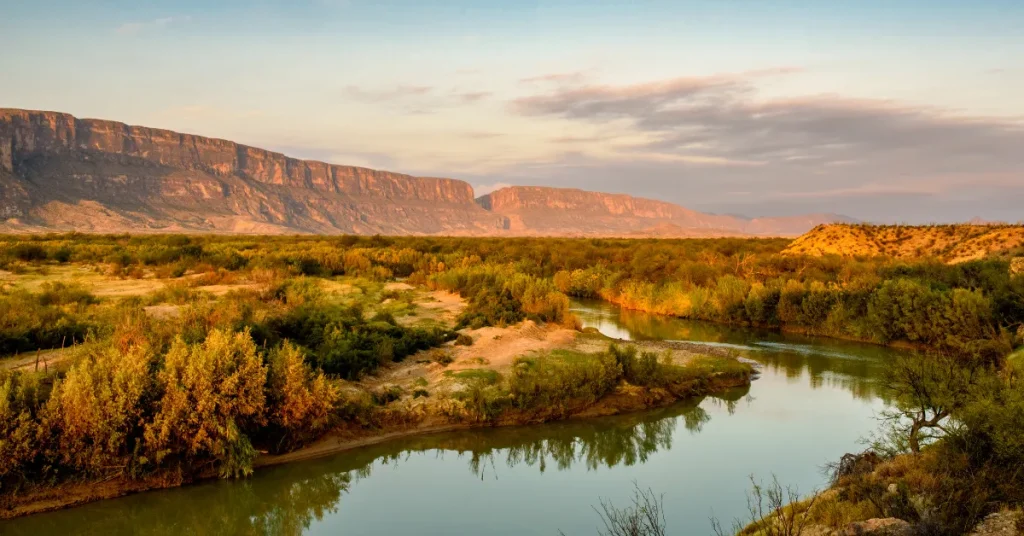
Many things decide how deep the Rio Grande is. The river’s path changes its depth. Mountains and valleys shape the riverbed.
- Canyons make the river narrow and deep.
- In wide valleys, the river is shallower.
- Rocky areas create varied depths.
Seasonal Changes Impacting River Levels
The river changes with the seasons. This affects how deep it is.
- Spring brings snowmelt. This increases depth.
- During summer, less rain can lower the river.
- Fall often has stable levels.
- Winter can freeze parts of the river, changing the depth.
Challenges In Determining Accurate Depths
The Rio Grande, a vital waterway, presents unique challenges to researchers. Efforts to measure its depth face numerous obstacles.
Varied topography and dynamic conditions add complexity to this task. Understanding its depths is crucial for ecology, safety, and navigation. Yet, accuracy in measurements remains elusive.
Environmental Factors Complicating Depth Assessment
River depths fluctuate, influenced by elements not easily quantifiable. To gauge the depth of the Rio Grande, consider these variables:
- Seasonal variations cause water levels to rise and fall.
- Weather events, such as storms, can swiftly alter depth.
- Silt and debris can accumulate, shifting the riverbed.
- Human activities, like damming, impact water flow and depth.
Technological Advancements In Riverine Studies
Advances in technology offer promising improvements in monitoring river depths. Tools and techniques include:
- Sonar systems provide real-time depth readings.
- Remote sensing uses satellite imagery to estimate depths.
- GIS mapping integrates data for comprehensive analysis.
- Drones offer aerial insights into inaccessible areas.
These innovations represent vital steps toward consistent, reliable data for the Rio Grande’s complex ecosystem.
Human Impact On The Rio Grande’s Ecosystem
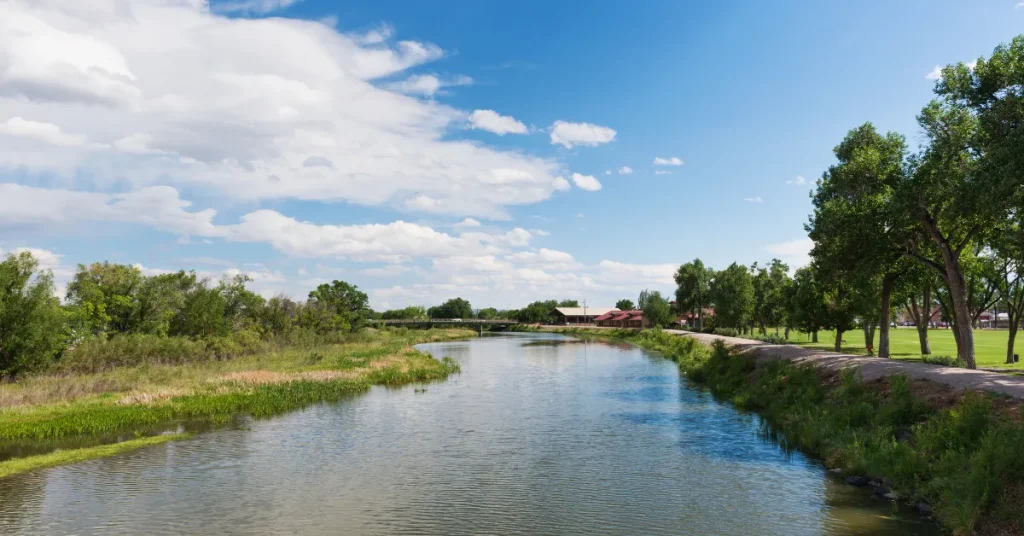
People have changed the Rio Grande’s ecosystem in many ways. This long river runs through Colorado, New Mexico, and Texas before reaching Mexico. As we use its water, the river faces challenges. Extra care can help keep this important river healthy for animals and us.
Water Usage And Its Effects On Depth
Using the Rio Grande’s water affects how deep the river is. Farms, cities, and factories take water from the river. When we use more water, the river gets shallower. This makes it hard for fish to live. It also changes where plants grow along the riverbanks.
- Farms: They need water for crops. They take a lot from the river.
- Cities: They use water for homes and businesses.
- Factories: They need water too. They also can add pollution.
| Activity | Water Taken | Impact on Depth |
| Farming | High | More shallow |
| City Use | Medium | Somewhat shallow |
| Factories | Varies | Changes depth |
Conservation Efforts To Maintain River Health
To help the Rio Grande, people are working on saving water. Saving water means the river can flow better. This help keeps the river deep enough for fish. Birds and plants along the river like this too.
- Education: Teaching people to use less water.
- Laws: Making rules about how much water people can take.
- Technology: Using tools that help save water.
New projects are in place to clean the river. Clean water is good for animals and plants. Together, everyone can make the Rio Grande a great home for all creatures.
The Future Of The Rio Grande
The Rio Grande, a vital water source for communities and ecosystems, faces uncertainty. Climate change and human activities raise questions about its future depth and health.
Addressing these issues requires understanding potential changes and sustainable management. Exploring predictions and practices for the Rio Grande is essential for its survival.
Predicting Changes In Depth Due To Climate Change
Climate change poses significant threats to the Rio Grande. Experts use models to predict how the river’s depth might change. Scientists suggest warmer temperatures will lead to:
- Increased evaporation
- Changed rainfall patterns
- Altered snowmelt schedules
These factors combine to affect river flow and depth. Data indicates potentially shallower depths in the future. Communities rely on accurate predictions to plan for water usage.
Sustainable Management Practices For River Longevity
Preserving the Rio Grande’s depth for future generations is crucial. Sustainable practices include:
| Practice | Benefit |
| Conservation initiatives | Reduce water waste |
| Riverbank restoration | Prevent soil erosion |
| Water-sharing agreements | Ensure equitable use |
Commitment to sustainability from all stakeholders is the key. This will help maintain the river’s depth and health. Education programs spread awareness, while technology offers new ways to monitor and manage the river effectively.
FAQs About How Deep Is Rio Grande
What Is The Average Depth Of The Rio Grande?
The Rio Grande’s average depth is approximately 3 to 15 feet. Water levels can fluctuate due to seasonal changes and regional precipitation patterns. It’s important to check current conditions for the most accurate depth measurements.
How Deep Can The Rio Grande Get?
In certain areas, particularly near the Rio Grande Gorge, the river can reach depths up to 60 feet. However, the depth varies significantly along its course, influenced by geographical features and hydrological conditions.
Does The Rio Grande Have Deep Sections?
Yes, the Rio Grande does have deep sections. These are typically found in canyons and gorges where the river is channeled through narrow spaces, significantly increasing its depth compared to wider, open areas.
What Affects The Depth Of The Rio Grande?
Several factors affect the Rio Grande’s depth, including seasonal rainfall, snowmelt from the mountains, dam releases, and water diversions for irrigation. These elements contribute to the variability of the river’s depth throughout the year.
Conclusion
Navigating the depths of the Rio Grande reveals a river rich in history and ecology. As we’ve explored, the river’s depth varies greatly, shaped by nature and human influences. Understanding its deepest points informs conservation and local culture.
By knowing the Rio Grande’s true depths, we deepen our appreciation for this geological treasure.
Resources:
1. https://www.nps.gov/bibe/learn/nature/riogrand.htm